Procore Maps: User Guide
- 最后更新
- 另存为PDF
目录
- 欢迎
- View Photos (Web)
- View Photos (iOS)
- View Photos (Android)
概况
Procore Maps seamlessly integrates your project images within an easy-to-navigate map, available at your fingertips anytime, anywhere. View photos on an interactive map to quickly understand work status and minimize delays.
Filter photos by date, pinpoint milestones, identify roadblocks and take action quickly. Ensure clarity and confidence in project execution with accurate geolocated data accessible to your entire team.
![]() |
![]() |
注意事项
- Procore Maps is currently available to use with the Photos tool.
- All photos appear on the map based on the location data in the photo. If the photos do not appear on the map, it is likely, that the photos do not contain location data. To confirm that your photos collect location data when you are capturing photos, see Android Location Data and iOS Location Data. You can also manually add photos to the map. See Add Item Pin to Map.
常见问题
- Procore Maps 目前与哪些工具集成?
- 在地图上可以看到哪些照片?
- 如何对照片进行映射?
- 为什么我的照片没有在正确的位置显示?
- 如果人员关闭了 Procore 应用程序的位置跟踪,会发生什么?
- Procore Maps 提供什么级别的准确性?
- Procore 地图和 Procore 地点有什么区别?
Procore Maps 目前与哪些工具集成?
Procore Maps currently integrates directly with the Photos tool, but because the Photos tool has the ability to consolidate photos used in other tools it also indirectly integrates with Drawings, Daily Log, Punch List, Observations, Inspections, and Action Plans. See Configure Advanced Settings: Photos to learn more about which tools are automatically consolidated into the Photos tool.
在地图上可以看到哪些照片?
公开照片仅对具有照片工具的只读或以上权限的用户可见。 私密照片仅对有权访问它们的用户可见。
如何对照片进行映射?
Procore 地图使用照片中的地点信息,自动将其放置在地图上。 此位置信息来自设备的GPS。 如果设备的定位服务关闭,则不会保存此信息。 请注意,此数据也可以通过电子邮件或某些 Web 浏览器删除,并且照片将指定为"未映射",没有纬度、经度值。 要绘制未映射的照片,请参阅将项目图钉添加到地图。
为什么我的照片没有在正确的位置显示?
Procore Maps uses the location information from the photo, or photo attached to an item, to place it on a map automatically. This location information comes from the device's GPS. If the device's location services are off, this information won't be saved. Please note that this data can also be stripped by email or by some web browsers and the photo will be designated as “unmapped” with no latitude, longitude values. To map an unmapped item, see Add Item Pin to Map.
Why aren't my items showing up in the right location?
All photos appear on the map based on the location data in the photo. If the photos do not appear on the map, it is likely, that the photos do not contain location data. To confirm that your photos collect location data when you are capturing photos, you must enable location tracking on your device. See Android Location Data and iOS Location Data.
However, sometimes a mobile device's location services are inaccurate due to issues like lag in location syncing or poor geographic coverage. While Procore cannot improve your device's accuracy, you can purchase third-party devices to enhance it.
Tip
You can manually move items on the map. See Move Item Pin on the Map.What is the best way to add photos to Procore so they appear on the map?
When creating items such as observations, inspections, and punch items, it's best to upload the photo from the device where the photo was taken, such as your smartphone. For third party devices, a direct copy from the camera to a photo app should maintain the necessary metadata.
When photos are transferred from a phone to a desktop, it's possible that the photo's metadata is removed, including the EXIF data needed to place the photo on the map.
Tip
- File format: Use JPEG format, as it usually retains most EXIF data compared to other image formats like PNG or GIF.
- Direct copy: When transferring photos from a camera to your computer, copy the files directly using your file explorer to retain EXIF data.
- Cloud storage settings: When using cloud storage services, select the 'original' quality option to retain EXIF data.
- Sharing as documents: If sending photos via email or messaging apps, attach them as documents instead of directly sharing images.
- Dedicated photo management software: Some specialized photo management software allows for EXIF data to remain intact during transfer.
Can I see mapped data on inactive projects?
Typically, yes. Any newly created items with photos that have EXIF data are automatically mapped on projects, regardless of project status.
However, if your project was inactive prior to Maps becoming generally available on January 22, 2025, your mapped data may not be available. If you need to see mapped data for these projects, please contact Support.
如果人员关闭了 Procore 应用程序的位置跟踪,会发生什么?
如果用户不允许该应用程序跟踪他们的位置,则他们将无法在地图上看到他们的位置,并且照片工具等工具将无法记录照片拍摄地的坐标。 如果照片不包含坐标,则会显示在"未制图"类别中,如果用户想在地图上看到它,则需要手动放置图像。
Procore Maps 提供什么级别的准确性?
Procore 依赖于直接来自用户硬件的GPS数据,这意味着我们对准确性的控制仅限于这些设备的功能。 如需了解GPS数据的准确性,我们建议参考Apple和Google等知名来源发布的外部文章,这些文章阐明了GPS技术的复杂性。 我们相信,定向准确数据的价值可以在决策过程中提供非常有价值的见解和帮助。 还有第三方设备可以在需要的情况下提高准确性。
Procore 地图和 Procore 地点有什么区别?
地图是平台的新增功能,它使用户能够查看地图上的对象,而位置为用户提供了一个可筛选字段,可用于将项目分组在一起。 Procore 中的"地点"设置起来非常麻烦,而且一旦做出努力,价值就有限。 但这种情况已经在改变。 AI 团队最近的工作是自动从建筑图纸中提取地点,目前处于测试阶段。 新成立的地点团队将继续在他们的转换工作的基础上,将地点提升为一个系统对象,而不仅仅是其他对象的标记。 Procore "地点"将扩展以包含它们自己的元数据,并将集成到 2D 和3D的所有空间体验中。 当用户将来使用"地点"标记项时,可以将项自动放置在地图、图纸或模型上其定义的区域内。
权限
Learn which user permissions are required to take the described actions in this tool.
重要提示
Users must have the below permissions for the Photos tool.
Some actions that impact this tool are done in other Procore tools. See the User Permissions Matrix for the full list of actions taken in all other tools.
权限
| | The action is available on Procore's Web, iOS, and/or Android application. Click to view the tutorial.
Users can take the action with this permission level.
Users can take this action with this permission level AND one or more additional requirements, like granular permissions.
| 操作 | 无 | 只读 | 标准 | 管理员 | 注释 |
|---|---|---|---|---|---|
|
将项目图钉添加到地图 |
|||||
|
配置地图视图 |
|||||
|
从地图下载项 |
|||||
|
从地图中通过电子邮件发送项 |
|||||
|
在地图上移动项目图钉 |
|||||
|
从地图中移除项目图钉 |
|||||
|
Set Base Map |
|||||
|
在地图上显示或隐藏项 |
|||||
|
Show Your Location on the Map |
|||||
|
从地图中查看项详细信息 |
|||||
|
在地图上查看照片 |
View Photos on Map
- 导航到项目的照片工具。
- 点击地图标签页。
- 查看已添加到地图的照片。
提示
从列表视图中,可以执行以下操作:
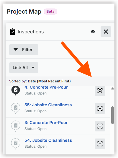
- 点击已绘制以查看已添加到地图的照片。
- Click the show on map
icon to center the item's pin on the map.
要将照片添加到地图,请参阅将项目图钉添加到地图。
View Photo Details
- 导航到工具的地图。
- Click the information
icon next to the photo.
OR
Click the photo on the map, then click the information
icon.
Add Photo Pin to Map
-
导航到工具的地图。
-
如果使用项目地图,请选择一个工具和列表
图标。 -
可选:点击列表并选择未映射以查看未映射项的列表。
-
点击添加到地图
图标。
-
将光标移动到地图上。 然后点击将图钉添加到所需位置。
Move Photo Pin to Map
-
导航到工具的地图。
-
如果使用项目地图,请选择一个工具和列表
图标。 -
点击在地图上查找
项旁边的图标点击地图上的该项。 -
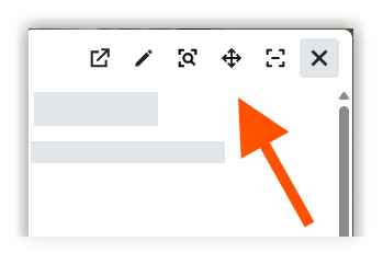
在预览窗口中,点击移动图钉
图标。
-
在地图上,点击并按住移动图钉
图标。然后将图钉拖到所需位置。 -
点击地图以确认新地点。
Remove Photo Pin from Map
-
导航到工具的地图。
-
如果使用项目地图,请选择一个工具和列表
图标。 -
点击列表并选择已映射以查看已映射项的列表。
-
点击项名称、地图图钉或缩略图以打开详细信息。
-
点击移除图钉
图标从地图中移除图钉。
搜索照片
- 导航到项目的照片工具。
- 在搜索栏中输入单词或短语。可以搜索以下字段:
- 从时间轴或地图视图
- 文件名
- 描述
- 备注
- 地点
- 行业
- 从相册视图
- 相册名称
- 相册中的照片
- 文件名
- 描述
- 备注
- 地点
- 行业
- 从时间轴或地图视图
- 点击搜索。
筛选照片
按属性筛选照片
- 导航到项目的照片工具。
- 点击添加筛选器 ,然后从以下选项中进行选择:
- 地点
- 通过选择“无”来搜索与某个地点无关的照片。
- 通过点击“包含子地点”,包含附加到正在搜索的地点的子地点的照片。
- 已加星标
- 隐私
注意:必须拥有“管理员”权限才能使用私密筛选器。 - 拍摄日期
- 上传日期
- 上传者
- 相册
注意:仅在时间线视图中显示。
- 地点
- 在菜单中,点击要作为筛选依据的筛选器属性。
- 点击菜单外进行申请。
按地图视图筛选照片
- 要按地图位置筛选照片,请点击地图标签页。
- 在地图上,点击地图筛选器。
- 选择在视图中,以仅查看当前地图区域中的项。
- 选择在地理围栏中以查看地理 围栏内的项。
- 点击鼠标以绘制地理 围栏的边界,以创建一个封闭区域,最后一次点击在第一次点击结束。
PROCORE 支持:内部说明
已为"标准"和"只读"用户删除隐私筛选器,因为他们没有查看"私密"照片的权限。
Show or Hide Photos
-
导航到工具的地图。
-
如果使用项目地图,请选择一个工具和列表
图标。 -
在列表视图中,执行以下其中一项操作:
-
点击显示
图标将所有项从显示更改为隐藏。 -
点击隐藏的
图标将所有项从隐藏更改为显示。
-
Configure the Map View
Change Base Map
- 导航到工具的地图。
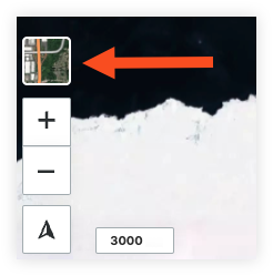
- Click the base map icon on the map.

- Select your preferred base map.
旋转地图
- 导航到工具的地图。
- Click the compass
icon and hold. Rotate the map to your desired orientation.
Note: Double clicking the compass arrow will reset the map orientation to north.
显示图钉或缩略图
- 导航到工具的地图。
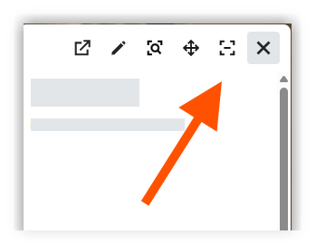
- Click the configure
icon. - Select one of the following options for your 'Photo Point Style':
- Thumbnails
- Pins
Email Photos
通过电子邮件发送单张照片
- 导航到工具的地图。
- Click the item name.
OR
Click the item on the map. - Click the email
icon.
- 输入电子邮件信息。
- 点击发送。
通过电子邮件发送多张照片
- 导航到工具的地图。
- Mark the checkboxes for the items you want to email.
OR
Tap and hold command or control on your keyboard and click the items on the map. - 点击批量操作并选择电子邮件。
- 输入电子邮件信息。
- 点击发送。
View Photos on Map
-
在 iOS 移动设备上导航到项目的照片工具。
-
点击
省略号 并选择 时间线
, 相册 fm=webp&h=27" style="显示:内联; vertical-align:middle;"
/> , 或 地图 查看以更改视图。 -
搜索或筛选照片。
请参阅搜索并筛选照片(iOS) 。 -
点击照片以查看详细信息。
-
要查看照片信息,请点击
图标在右上角。
此时将出现照片信息屏幕。它包含标记清晰的模块部分 - 隐私、描述、相册、地点、行业、地图数据、照片数据和项目数据。你可以滑动每个部分以快速查看和编辑字段。它可以帮助你正确标记和标记照片,提高可搜索性和长期项目文档。 -
(可选)要在 360 度图像模式下查看照片,请使用360 度图标。
可以查看无缝、全屏的 360 度图像。
搜索并筛选照片
搜索照片
- 使用 iOS 移动设备上的 Procore 应用程序导航到项目的照片工具。
- 可选:点击省略号
和 选择时间线
、实>相册
,或地图
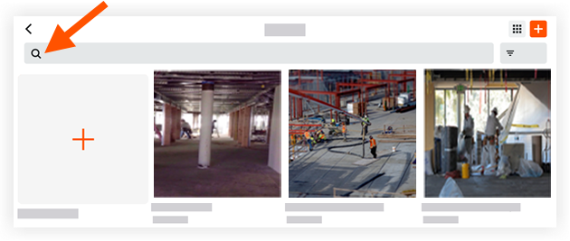
Genecore_media/Procore_Inline_Icons" sRC。文件名》 icon-地图-moble.png 》视图以更改你查看项目照片的方式。 - 点击搜索栏以输入关键词或短语。
注意:此搜索将返回与以下项匹配的信息:- 从时间线视图
- 文件名
- 描述
- 从相册视图
- 相册名称
- 从地图视图
- 文件名
- 描述
- 从时间线视图
- 点击照片以查看其详细信息。
筛选照片
- 使用 iOS 移动设备上的 Procore 应用程序导航到项目的照片工具。
- 点击选项菜单
并选择时间线视图
或地图
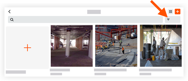
。 / 。强烈> - 点击筛选器
图标。 
- 从以下选项中点击要应用的筛选器:
- 分组依据:选择按“月”、“周”和“日”筛选照片。
- 筛选依据:选择按以下选项筛选照片:
- 日期范围:输入日期 范围以按照片的拍摄日期筛选照片。
- 私密:点击此选项可按"公开"或"私密"筛选照片。
注意:按隐私状态筛选仅在选项中的"时间线视图"中可用
菜单。 - 地点:点击此选项可按关联地点筛选照片。
- 行业:点击此选项可按关联行业筛选照片。
- 点击应用。
- 可选:点击重置以清除应用的筛选器。
Show Current Location on Map
- 导航到工具的地图。
- 点击指南针
图标。
地图以你当前位置为中心。
Change Base Map
- 导航到工具的地图。
点击底图
图标。 - 点击想作为地图背景的底图:
- 地势
- 天气预报
- 深色
- 光
- 无
- 点击X保存。
View Photos on Map
-
使用 Android 移动设备上的 Procore 应用程序导航到项目的照片工具。
-
点击 相册 、
时间线
, 提要 fm=webp&h=21" style="显示:内联; vertical-align:middle;"
/> , 或 地图 图标以更改你的视图。
注意:图标会根据当前选择的视图而变化。 -
点击要查看的照片。
-
要查看照片信息,请点击
图标在右上角。
此时将出现照片信息屏幕。它包含标记清晰的模块部分 - 隐私、描述、相册、地点、行业、地图数据、照片数据和项目数据。你可以滑动每个部分以快速查看和编辑字段。它可以帮助你正确标记和标记照片,提高可搜索性和长期项目文档。 -
(可选)要在 360 度图像模式下查看照片,请使用360 度图标。
搜索并筛选照片
- 使用 Android 移动设备上的 Procore 应用程序导航到项目的照片工具。
这将显示该项目的照片提要。
搜索照片
- 点击搜索
屏幕顶部的图标。 - 输入关键词或短语。
注意:此搜索将返回匹配以下项的信息:- 从提要视图:
- 描述
- 地点
- 用户
- 从时间线视图:
- 描述
- 地点
- 用户
- 从相册视图中:
- 相册名称
- 从地图视图:
- 描述
- 地点
- 用户
- 从提要视图:
- 可选:点击 X 以清除应用的搜索。
筛选照片
- 点击时间轴
、源
或 地图
强>图标可更改视图。
注意: 图标会根据当前选择的视图而变化。 - 点击筛选器

屏幕顶部的图标。
- 点击以按以下选项分组:
- 月
- 周
- 日
- 点击以下一个或多个选项:
- 日期范围:输入日期 范围以按照片的拍摄日期筛选照片。
- 地点:点击此选项可按关联地点筛选照片。
- 行业:点击此选项可按关联行业筛选照片。
- 私密:点击此选项可按“公开”或“私密”筛选照片。
- 已加星标:点击此选项可显示所有已加星标的照片。
- 点击应用。
- 可选:点击重置以清除应用的筛选器。
Show Current Location on Map
- 导航到工具的地图。
- 点击指南针
图标。
地图以你当前位置为中心。
Change Map Background
- 导航到工具的地图。
- 点击想作为地图背景的底图:
- 地势
- 卫星地图
- 深色贴图
- 照明贴图
- 点击X保存。